GPSMAP 722


GPSMAP 722 chartplotter with a 7-inch touchscreen and intuitive controls, as well as NMEA2000 and NMEA0183 support. Product details
This product is no longer available. But a successive product is available:
Available variants


Product details
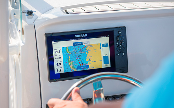
- 7-inch high-resolution intuitive touchscreen controls
- NMEA 2000® and NMEA 0183 support for network connectivity
- Garmin Marine Network support for sharing sonar, including Panoptix™ sonar, maps, user data, radar and IP cameras among multiple units
- Supports optional BlueChart® g2 Vision® HD charts for Auto Guidance and other premium navigation features¹

Garmin Marine Network and NMEA 2000 Support
Full-network compatibility allows you to add more capabilities to your boat. Garmin Marine Network support allows sharing of sonar, including Panoptix FrontVü collision avoidance sonar, maps, user data, dome or open-array radar and IP cameras among multiple units. Plus, there’s NMEA 2000 network connectivity and NMEA 0183 support for autopilots, digital switching, weather, FUSION-Link, VHF, AIS and other sensors.
Built-in Wi-Fi® Connectivity
Enjoy built-in Wi-Fi connectivity for BlueChart Mobile 2.0 and Garmin Helm apps. Garmin Helm allows you to view and control your compatible chartplotter from a compatible smartphone or tablet while providing enhanced situational awareness for the mariner. With BlueChart Mobile, a free app downloaded from the App Store™, you can get reliable weather information while you plan marine routes on your iPad® or iPhone® then wirelessly transfer them to your boat’s compatible networked Garmin chartplotter. You can even stream and control a VIRB action camera from the chartplotter.
Built-in ANT® Connectivity
Enjoy built-in ANT wireless connectivity directly to quatix® marine watch, Garmin Nautix™ in-view display, gWind™ Wireless 2 transducer, GNX™ Wind marine instrument and wireless remote controls.Heading and Position Refreshed 10 Times per Second
Fast, responsive built-in 10 Hz GPS and GLONASS receiver refreshes your position and heading 10 times each second to make your movement on the screen more fluid. It makes dropping up to 5,000 accurate waypoints — and finding your way back to them — quick and easy.Upgrade to Our Best Maps on the Water
Includes expandable memory for accessory map purchases, such as LakeVü HD Ultra with Max Def Lakes or BlueChart g2 Vision HD, which adds Garmin patented Auto Guidance¹ and other great features.

Built-in SailAssist Features
To help you gain a wind-maximizing competitive edge, your chartplotter features a pre-race guidance page that shows your virtual starting line along with data fields showing laylines, time to burn before the start and a race timer that can be synchronized across all your networked Garmin GPS products. In addition, other supported sailing features include an enhanced wind rose, heading and course-over-ground lines, set and drift, true and apparent wind data and more.
GPX Waypoints Transfer
If you have waypoints, tracks or frequently used routes stored on another manufacturer’s GPS product — or on a Garmin handheld device — it’s easy to transfer those items to your new Garmin chartplotter via industry-standard GPX software formatting.
Technical Data:
| Dimensions | 8.8" x 5.6" x 2.1" (224.0mm x 142.5mm x 53.9mm) |
| Display Size, W x H | 6.1" x 3.4" (154.08mm x 85.92mm) |
| Display Resolution, W x H | 800 x 480 pixels |
| Display Type | Multitouch-WVGA-Touchscreen |
| Weight | 0.86 kg |
| Antenna | Internal or external over NMEA 2000 |
| NMEA 2000 Compatible | Yes |
| NMEA 0183 Compatible | Yes |
| SiriusXM™ Weather & Radio compatible | Yes |
| Mounting options | Bail or flush |
| Garmin Marine Network™ ports | 1 |
| Preloaded Maps | No |
| Accepted Data Cards | 2 microSD™ cards |
| Waypoints | 5,000 |
| Routes | 100 |
| Track Log | 50,000 points; 50 saved tracks |
| Garmin Radar compatible | Yes |
| Garmin Sonar compatible | Yes (with external black box, sold separately) |
| Garmin SmartMode compatible (customizable monitor presets) | Yes |
| Supports AIS (tracks target ships position) | Yes |
| Supports DSC (displays position data from DSC-capable VHF radio) | Yes |
| Tide tables | Yes |
| Garmin Meteor™ Audio System compatible | Yes |
| Supports FUSION-Link™ compatible radios | Yes |
| GSD™ Black Box sonar support | Yes |
| GCV™ Black Box sonar support | Yes |
| BlueChart® Mobile (planning) compatible | Yes |
| Garmin Helm compatible | Yes |
| GRID™ (Garmin Remote Input Device) compatible | Yes |
| Wireless remote compatible | Yes |
| CHIRP sonar technology | Yes (with external black box) |
| ClearVü | Yes (with external black box, sold separately) |
| SideVü | Yes (with external black box, sold separately) |
| NMEA 0183 input ports | 1 (Differential) |
| NMEA 0183 output ports | 1 (Differential) |
| Video input ports | 1 BNC |
| Video output ports | None |
| Wireless connectivity | Yes |
| Additional | User interface: Multi-touch touchscreen, Auto backlight dimming: Yes, VIRB® compatible, Wearables compatible through ANT, gWind wireless compatible |
| Delivery contents | GPSMAP 722 chartplotter, Power cable, Bail mount kit with knobs, Flush mount kit with gasket, Protective cover, Trim piece snap covers, Documentation |
Documents
Product safety


Customers ask customers
No questions asked yet. Be the first to ask a question!
More "Customers ask customers" available in the following languages
Customers also bought

DELIUS-KLASING
Chart Pack 9 - Balearic Islands
only
€69.90
2
WHALE
Connect Plumbing System / blue tubing
only
€2.50
422
BAVARIA
Main Panel 301
only
€1,379.95
3
BAVARIA
Door Stop Protector / Wall Guard
only
€4.40
BAVARIA
Anuba Notch Hinge
only
€11.95
BAVARIA
Thermostat for Circulating Air Evaporator Type 15
only
€87.95
5
BAVARIA
Locking Lever for Bimini
only
€26.95
BAVARIA
Linear Actuator for Bathing Platform
only
€2,599.95
WHALE
Connect Plumbing System / red tubing
only
€2.50
473
Splice online

GLEISTEIN
DOCK-TWIN Mooring Line / navy blue
from
€2.70
6 variants
Similar items
-9%
GARMIN
GPSMAP 723 Multifunction Display
€1,049.00
only
€949.95
2
-7%
GARMIN
GPSMAP 723xsv with Sonar Module
€1,259.00
only
€1,169.95
2
-6%
GARMIN
GPSMAP 923
€1,579.00
only
€1,479.95
2
-6%
GARMIN
GPSMAP 923xsv with Sonar Module
€1,789.00
only
€1,679.95
1
-7%
GARMIN
GPSMAP 1223
€3,048.99
only
€2,849.95
Expected to be in stock within 1-2 weeks
-5%
GARMIN
GPSMAP 1223xsv with Sonar Module
€3,259.01
only
€3,079.95
Expected to be in stock within 4-6 days
GARMIN
GPSMAP 8410
only
€2,799.95
> 4
-8%
GARMIN
GPSMAP 8410xsv
€3,149.00
only
€2,899.95
Expected to be in stock within 1-2 weeks
-7%
GARMIN
GPSMAP 8412
€4,099.00
only
€3,799.95
> 7
GARMIN
GPSMAP 8416
only
€6,199.95
Last seen products
E-mail Newsletter
Product news, offers & new guide videos. Stay up to date!
WhatsApp
New: Get news from SVB straight to your phone!