RAYMARINE Element 7S / buttons / CHIRP Sonar Module / with Lighthouse Chart
SVB item number: 81712
Manufacturer no.: E70531


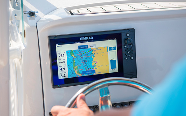
Smart 7" multifunction display with user-friendly interface, integrated GPS antenna and built-in CHIRP sonar module. A touch screen was deliberately omitted from this Raymarine plotter, as the classic button controls in connection with the Raymarine Lighthouse Sport operating system make for intuitive and precise control of the device, even at high speeds and strong seas.
Please select the desired Lighthouse chart module below in the product description before adding the product to your shopping basket. Product details
Please select the desired Lighthouse chart module below in the product description before adding the product to your shopping basket. Product details
Recommended retail price:
€529.55
only
€399.95
-24%
You save: €129.60
> 37
| in stock
Having issues?
If you are not redirected to PayPal, it could be due to your browser settings. Please check and if necessary deactivate the setting "Hide IP address" in the settings -> Safari -> Hide IP address. Please also check your browser for updates.
If you are not redirected to PayPal, it could be due to your browser settings. Please check and if necessary deactivate the setting "Hide IP address" in the settings -> Safari -> Hide IP address. Please also check your browser for updates.
Are you already using this item?
Add to my boat now.
At a glance!
Product data
- SVB item number 81712
- EAN 0723193827987
- Manufacturer no. E70531
- Description RAYMARINE Element 7S multifunction display / without transducer
- Series Element
- Display size 7 Inch
- Resolution 800 x 480 px
- Operating mode Keys
- With transducer No
- Viewing angle 70 °
- Screen brightness 1500 Nits
- Operating voltage 12 V
- NMEA0183 No
- NMEA2000 Yes
- Ethernet / Network No
- WiFi Yes
- Bluetooth Yes
- Radar capable Yes (only via WiFi)
- Tablet control No
- Sonar module Yes
- Sonar type CHIRP / Fishfinder, Numerical depth
- Viewing angle Downwards
- Nautical chart support Yes
- Sea Charts C-MAP 4D, Navionics+, Navionics Platinum+, LightHouse Charts
- Installation width 225 mm
- Installation height 120 mm
- Sonar view Fish
- IP protection class IPX7
- Compatible Raymarine transducers CPT-S CHIRP
SVB recommends


Accessories


Product details


Smart 7" multifunction display with user-friendly interface, integrated GPS antenna and built-in CHIRP sonar module. A classic keypad and the Raymarine LightHouse Sport interface make for intuitive operation, further enhanced by custom programmable function keys. A built-in QuadCore processor provides plenty of computing power. Easy networking thanks to NMEA2000 connection.
Raymarine LightHouse Sport
Intuitive and visually striking user interface. Thanks to pre-configured home screens, every user has the start screen needed for his or her needs immediately at hand. With the ergonomically positioned buttons, navigation through the menus and placing waypoints and routes is quick and easy even without a touchscreen. Through an NMEA2000 interface, the Element-S can display a wide range of data from external devices such as AIS receivers or tank sensors.
Choose from a wide range of sailing areas with support for Navionics and C-MAP 4D charts.
Raymarine Quantum Radar

Raymarine QUANTUM is the next generation of marine radar antennas with CHIRP technology. The QUANTUM provides razor-sharp images over both short and long distances.
NMEA2000 support

With the NMEA2000 (Micro-C) interface you can clearly display AIS, tank, engine, compass and wind data. This allows you to view incoming AIS targets directly on nautical charts and keep an eye on the surrounding shipping traffic. With the help of the data bar you can monitor your current tank levels for instance.
Fishfinder - CHIRP
Go underwater hunting with the Element S series. Spend more time catching fish and less time searching! The CHIRP Fishfinder module (transmitter/transducer optional) provides high-resolution underwater images.
Recommended transducers


Both transducers can be used for fishfinder CHIRP display:

Fishfinder chirp
Depth / fishfinder viewsDepending on which the transducer is connected, the chartplotter can display the following depth views. The pure depth display refers to transducer data received via NMEA0183 or NMEA2000 interface. Some functions can be retrofitted via external modules.
Pure depth representation |
Fish finder / CHIRP |
Down vision |
RealVision 3D |
Technical specifications
| Screen size | 7" |
| Touchscreen | Non-Touch |
| Screen resolution | 800 x 480 |
| Brightness | 1500 nits |
| Network and compatibility | |
| GPS | Integrated GPS / GNSS receiver: GPS / GLONASS |
| Nautical charts specification | |
| Supported nautical charts | Raymarine LightHouse NC2, Navionics, C-MAP Essentials, C-MAP 4D MAX+ and all charts listed on the Raymarine Chart Store. |
| Waypoints routes | 10,000 waypoints / 200 waypoints groups / 250 routes with max. 500 waypoints / 15 tracks - 10,000 track points per track |
| Other specifications | |
| NMEA2000 | Data input: engine, tank sensor, compass, AIS, depth, wind and speed data Data output: GPS data for radios, waypoints and routes for autopilots |
| Other interfaces | Wi-Fi |
| Dimensions | 240 x 135 x 62 mm |
| Nominal voltage | 12 V DC (8 V - 16 V DC) |
| Power consumption (amps) | 15 W |
| Water rating | IPX6 and IPX7 |
| Operating temperature | -25 °C to + 55 °C |
Chart module:
SD/Micro-SD |
Compactflash |
C-Card MAX orange |
C-Card NT+ black |
Compatible with the following charts:
| C-MAP 4D | C-MAP 4D Full | C-MAP 4D Continental | Navionics+ | Navionics Platinum+ |
Chart features:
| Chart system | Vector maps | Grid/paper charts | Easy/Autorouting | Tides | Satellite images | High-resolution depth lines |
| C-MAP 4D | ||||||
| C-MAP 4D Full | ||||||
| C-MAP 4D Continental | ||||||
| Navionics+ | ||||||
| Navionics Platinum+ |
Features
Discover the features that make this product stand out. From technical details to special functions – we’ve summarized all the key information for you.
Display size
7 Inch
Operating mode
Keys
No
Radar capable
Yes (only via WiFi)
Yes
Viewing angle
Downwards
Sonar view
Fish


Delivery contents
- Element display
- Surface mount gasket
- Suncover
- Trunnion knobs
- Mounting bracket
- Mounting material
- Power and data cable

Documents
Systems
Product safety


by
Herbert L.
 10/4/2025
Verified purchase
Variant:
81712
in use on a Bavaria Yachtbau GmbH - BMB 25 DC
10/4/2025
Verified purchase
Variant:
81712
in use on a Bavaria Yachtbau GmbH - BMB 25 DC
Images for this rating


Customers ask customers
Question about delivery contents
Goran P.
| Apr 23, 2026

What kind of charts are included?
Answer from SVB customer service
M. B.
| Apr 23, 2026
Hello Goran, you can choose between the Lighthouse Europe-North, Europe-West or Mediterranean charts. Regards SVB-Team Bremen
Answer from SVB customer service
Andreas M.
| Apr 23, 2026
Hi Goran, please look at the 4th picture on the top of this site. There, you can see that 3 different areas are available. North Europe, West Europe or Mediterranean Sea.Once you've chosen a map, you'll see a “Choose your chart” dropdown menu at the top of the product description. When you add the plotter to your cart, the chossed map will be added automatically.
Technical question
Mait K.
| Oct 19, 2022
Hello! Does the Element 7S plotter work with Airmar 800UDST ultrasonic triducer via NMEA2000 network?
Answer from SVB customer service
Cory V.
| Mar 8, 2023
Dear customer, yes fully funtional on nmea2000.
Technical question
Klaus S.
| Sep 13, 2020
Can i Reuse the map that I have in my raymarine C70 or do I have to buy a new map.
The actual data can be used, but the element needs the information on a micro-SD card and not on a CompactFlash memory like yours. So at least the data carrier must be changed.
Question about delivery contents
Svajunas B.
| Nov 28, 2019
1. Whether the MicroSD memory card is sold with a Nautical chart ? 2. Do I understand correctly, that I need to buy SeaTalkNG to NMEA2000 adapter to connect the device to the Seatalk NG Backbone ?
Answer from SVB customer service
Arne C.
| Nov 29, 2019
Hello Svajunas, you are right. For a connection to Seatalkng you must adapter. And for the element there is a seachart, that can seperat buyed, see our seachartfinder https://www.svb.de/services/seachart
Raymarine adapter cable A06045 (SeaTalk NG to NMEA 2000 female) - SVB article number #60707# - is required to integrate the unit into a Seatalk NG system.
Answer
Svajunas B.
| Nov 29, 2019
Hi, Thank You for Your answer. What are the main differences between the Model Noo.E70531 and Model No. E70532?
Customers also bought

SIKA
Sikaflex - 291i Marine Sealant / Filler
from
€8.95
(€127.86 / L)
6 variants
-32%
YACHTICON
Captain-Tolleys Sealant / 60 ml
€21.96
only
€14.95
(€249.17 / L)
> 100
Mega LED 60 / BAY15D
only
€19.95
> 100
Leak and Emergency Plug Set
only
€8.50
> 100
-10%
RAYMARINE
SeaTalk1 to SeaTalkNG Converter Kit
€154.70
only
€139.95
15
NMEA2000
Starter Kit / Micro-C
only
€133.95
> 100
-7%
RAYMARINE
Adapter Cable SeaTalk NG to NMEA 2000 / female
€53.55
only
€49.95
90
RAYMARINE
Installation Kit for Element 7
only
€56.95
Available on 08.06.2026
-8%
NAVIONICS
Navionics+ Scandinavian south & Germany North / 45XG / NAEU645L / Large
€250.00
only
€229.95
62
Similar items
-28%
RAYMARINE
Element 9 HV / buttons / with Hypervision sonar without transducer / with Lighthouse Chart
€886.55
only
€639.95
9
-6%
LOWRANCE
Eagle 5 with SplitShot™ HD Transducer
€391.51
only
€369.95
1
-8%
LOWRANCE
Eagle 7 with SplitShot™ HD Transducer
€546.21
only
€499.95
Expected to be in stock within 4-6 days
-8%
LOWRANCE
Eagle 7 with TripleShot™ HD Transducer
€653.31
only
€599.95
Available on 15.06.2026
-6%
LOWRANCE
Eagle 9 with TripleShot™ HD Transducer
€831.81
only
€779.95
1
-16%
LOWRANCE
Eagle 9 with 50/200 kHz HDI Transducer
€772.31
only
€649.95
3
E-mail Newsletter
Product news, offers & new guide videos. Stay up to date!
WhatsApp
New: Get news from SVB straight to your phone!